
Renowned novelist, Henry David Thoreau, once expressed, “Not until we are lost do we begin to understand ourselves.” This profound sentiment holds especially true when one dives into the realm of wilderness navigation and outdoor adventures. In today’s world, where technology often supersedes traditional knowledge, the importance of mastering map and compass skills can’t be overstated.
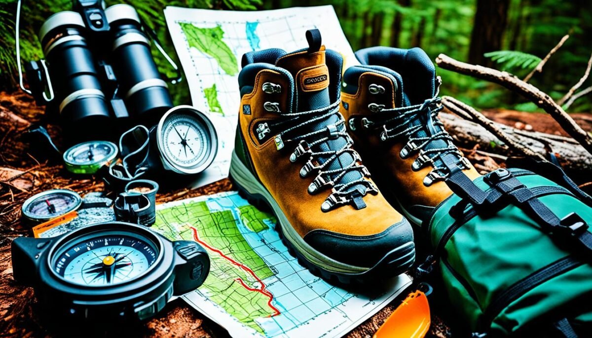
These essential tools of navigation, the map and compass, might seem antiquated amidst the modern GPS technology. However, they are the bedrock of wilderness navigation, setting the foundation for safe and effective exploration. The knowledge of utilizing these tools affords us a level of independence and assurance that cannot be replicated by any digital alternatives.
In my journey of map and compass training, I’ve discovered a deeper connection with nature while threading through challenging terrains, traversing unmarked trails, and navigating unknown locations. This art of navigation not only instills confidence but also cultivates a deep-seated respect for the wilderness and the adventures it offers.
Key Takeaways
- Map and compass skills are fundamental to safe and efficient wilderness navigation.
- Mastering these skills fosters independence and confidence during outdoor adventures.
- Map and compass training leads to a deeper understanding and appreciation of nature.
- These traditional navigation tools hold timeless value, providing reliable guidance even when technology fails.
- The art of navigation is more than just about finding one’s way; it is about connecting deeper with the natural world and exploring the boundaries of one’s capabilities.
Table of Contents
The Importance of Mastery in Map and Compass Skills
For any outdoor enthusiast, gaining expertise in map and compass skills is not merely an option—it’s a necessity. In an era where technological advancements dominate nearly all facets of life, the reliability of these tangible, hand-held tools remains unchallenged, cementing their position as foundational in the realm of outdoor adventure and orienteering.
The reason why these tools have stood the test of time is largely down to their intrinsic functionality and simplicity. The ability to accurately read a map opens up a world of unexplored territories—untouched wilderness waiting to be conquered by those bold enough to navigate it. And a compass—this small, silent instrument is a navigator’s most trusty ally, invariably helping in charting a course true to the call of adventure.
In contrast to digital devices, which may falter or run out of power, proficiency in map reading and compass navigation instills an inherent confidence within explorers. This self-reliance not only allows for safe and efficient travel, incorporating elements of land navigation and orienteering skills, but also ingrains a deep-rooted connection with nature that builds character.
“In every walk with Nature one receives far more than he seeks.” – John Muir
On that note, let’s delve deeper into how you can enhance your proficiency in these skills and become versed in outdoor navigation.
- Map and Scale Reading: Learn to interpret different scales and map legends.
- Compass Skills: Understand the basics of a standard baseplate compass and how to determine bearings.
- Orienteering Skills: Practice using landmarks and natural features for navigation.
- Distance Estimation: Get comfortable with calculating distances and time estimation.
- Precision: Hone your skills in reading latitude and longitude coordinates for pinpoint accuracy.
By honing these skills, you can venture into the heart of the wilderness with the assurance that you are well equipped to face the exhilarating uncertainties of the great outdoors. So, strap on your backpack, grab your map and compass, and step forward into the wild—with every footstep, you’re writing your own adventure story.
Understanding Compass Basics for Reliable Navigation
To navigate reliably in the wilderness or any outdoor environment, one must have a fundamental understanding of compass basics. The compass, especially the popularly used baseplate compass, remains an essential tool in navigation despite the advent of digital technology. Knowing how to effectively interpret a compass’s components significantly impacts your outdoor success.
Components of a Standard Baseplate Compass
A standard baseplate compass contains several key components. These include the transparent baseplate marked with a direction-of-travel arrow and scales, the rotating compass housing adorned with orienteering lines and a dial marked in degrees, and a floating, magnetized needle. In a top-notch baseplate compass, you’ll often see additional elements such as a magnifying lens, multiple scales for map reading, a lanyard hole, and luminescent indicators for low-light conditions.
The Magnetized Compass Needle and its Significance
The centerpiece of any compass, including the baseplate compass, is the magnetized needle. This needle, often colored red on the north end and white or black on the south end, aligns itself with Earth’s magnetic field. It aims to provide precise direction guidelines. Even with variations in Earth’s magnetic field, the magnetized compass needle remains reliable as it points to the magnetic north, not the true geographic north.
These distinct, but interconnected components ensure that your compass leads you in the right direction. Familiarizing with them and understanding their functions can deepen your connection with outdoor navigation, making every adventure a memorable experience.
Deciphering Map Basics: Symbols, Scales, and Legends
Acquiring an understanding of map basics, including map symbols, map scales, and map legends, is integral to achieving proficiency in map reading and navigation. When we delve into the world of maps, we realize that these tools intricately represent the natural and man-made world, breaking down complex landscapes into understandable graphical symbols. Let’s break down these elements and discover their significance in helping us to navigate the great outdoors.
Map Symbols are visual representations used on maps to depict various real-world elements. For example, blue may indicate bodies of water, green may denote forests, and black or red may denote roadways and trails. In addition, various symbols may denote heal visitor centers, campgrounds, or landmarks. Understanding these symbols allows navigators to interpret the terrain and understand the features present in the area.
Map Scales is a representative fraction that illustrates the relationship between a distance on the map and the corresponding distance on the ground. For instance, a scale of 1:1000 means that every 1 unit on the map corresponds to 1000 units in the real world. Such an understanding can be imperative in estimating travel time and distance to our destination.
Map Legends, also known as a key, is a graphical representation that explains the symbols used on the map. This includes symbols for different types of roads, trails, and landforms. Gaining a solid understanding of the map legend enables us to grasp the collective information the map provides, thus empowering us to navigate the landscape effectively.
Next, let’s take a look at this table which touches upon some common map symbols, their general colors, and what they represent:
| Symbol | Color | Description |
|---|---|---|
| Lines | Brown/Black | Land Contours/ Roads and Paths |
| Wavy Lines | Blue | Rivers or Streams |
| Circles or Semi-Circles | Green | Forest Bounding Lines |
| Dots | Black | Buildings or Individual Trees |
In conclusion, an understanding of map basics, decoding map symbols, engaging with map scales, and effectively interpreting map legends are vital skillsets one must familiarize themselves with in order to confidently embark on a wilderness adventure. Such knowledge will ultimately enrich your outdoor experiences, adding to your overall safety and enjoyment in the wilderness.
Comprehending Topographic and Nautical Maps for Outdoor Adventures
In the exciting world of outdoor adventures, unambiguous interpretation of topographic and nautical maps is crucial. These maps, while seemingly complex, are abundant sources of detailed information, instrumental in navigating various landscapes safely and confidently. Let us delve into understanding these maps better.
Interpreting Contour Lines on Topographic Maps
When it comes to land-based adventures, topographic maps are a navigator’s best friend. A defining feature of these maps is the inclusion of contour lines. These lines represent the shape and elevation of the landscape at a specific interval, providing a detailed view of terrain relief. This visualization is particularly valuable during hiking or mountain climbing, facilitating the planning of elevation gains or losses.

The table below illustrates what different contour lines represent on a topographic map.
| Type of Contour Line | Description |
|---|---|
| Index Contour Lines | These are the thicker contour lines that are usually every fifth line to help you understand the changes in the elevation on the ground. |
| Intermediate Contour Lines | Lines falling between the index contour lines which offer a more detailed view of the elevation gradient. |
| Supplementary Contour Lines | Dashed lines often used in flat terrains to provide more information about the landscape. |
Navigating Waterways Using Nautical Charts
Embarking on a maritime adventure calls for a comprehensive understanding of nautical charts. Packed with information about water depths, coastlines, potential hazards, and the locations of aids to navigation such as lighthouses, these charts are indispensable for safe sea or river navigation.
Nautical charts provide mariners with a clear image of what is underneath the water and around the boat, allowing them to avoid dangers and plan alternative routes if necessary. It’s no hyperbole to say that mastery of these detailed maps can make a significant difference in sailing, fishing, or engaging in other water-borne adventures.
In conclusion, deciphering topographic and nautical maps is an essential skill, offering a wealth of information that can enrich and ensure safe outdoor adventures. Whether you are traversing steep mountains or navigating challenging waterways, these maps will serve as trustworthy guides on your next adventure.
Accurately Reading Latitude and Longitude Coordinates on Maps
As essential tools of navigation, latitude and longitude coordinates play a significant role in pinpointing precise locations on a map. Derived from a geographical coordinate system, these units serve as the backbone to the world’s navigation and geographic systems. Let’s delve into the subtle differences between these two types of map coordinates and understand the importance of their respective roles in overall geographical navigation.
Differentiating Between Latitude and Longitude
Latitude refers to the lines that run east-west on the globe, measuring the distance north or south from the equator. They are horizontal lines, parallel to each other and to the equator. On the other hand, longitude lines run from the North Pole to the South Pole, measuring the distance east or west from the Prime Meridian (which passes through Greenwich, London). Unlike latitude lines, longitude lines are not parallel and converge at the poles.
Note: Latitude is always given before Longitude in map coordinates.
Applying Coordinates for Pinpointing Precise Locations
The utility of understanding latitude and longitude coordinates extends beyond merely reading a map. Employing these coordinates effectively can enhance navigation capabilities while confirming your exact location during an outdoor journey. Rather than merely following trails, the ability to read map coordinates can allow for more adventurous off-trail exploration with the confidence of knowing you can locate yourself accurately.
By overlaying a grid of latitude and longitude lines onto a map, the entire Earth can be divided into squares, each with a unique set of coordinates. This grid system is what GPS devices use to deliver precise navigational details. When paired with a reliable map, effective use of latitude and longitude coordinates can transform your outdoor adventures by giving you the freedom to explore more confidently.
In a nutshell, mastering latitude and longitude concepts will elevate your outdoor navigation skills. Whether you’re planning a hike in the Rockies or coastal sailing off the Atlantic, these skills are crucial for conquering any geographical challenge that comes your way.
Map and Compass Training: Orienting a Map with a Compass

Orienting a map with a compass is a fundamental skill in wilderness navigation. This critical ability enables accurate navigation and planning during outdoor excursions. The process involves matching the map’s ‘north’ with the compass’s ‘north’, aligning your physical environment with its depiction on the map.
This technique is key to the successful utilization of a map in conjunction with a compass for determining bearings, setting a course, and reaching your desired destination. Let’s dive deeper into the steps involved in this crucial process.
- Place your map on a flat surface and lay your compass on the map. The edge of the baseplate should be along your intended path.
- Rotate the compass housing so that the orienting lines are parallel with the map’s north-south grid lines, and north (on the compass) is pointing to north on the map.
- Turn yourself, the map, and the compass as a single unit until the magnetized needle aligns with the orienting arrow. You now have a map that reflects your surroundings accurately.
Practicing these steps regularly will enhance your proficiency in orienting a map, an indispensable skill when it comes to wilderness navigation.
“The art of wilderness navigation begins with a well-oriented map. The confident stride of an experienced outdoorsman arrives from knowing where he steps next, and that knowledge is born from accurate map orientation.”
| Steps | Functions |
|---|---|
| 1. Lay your compass on the map | Every journey begins by establishing where you are and where you intend to go. Laying the compass on the map initiates this process. |
| 2. Rotate compass housing | This movement aligns the north on the compass with the north on the map, connecting the physical world with its representation. |
| 3. Align the magnetized needle and orienting arrow | This synchronization of compass elements furthers orient the map, fine-tuning the reflection of the environment. |
With these skills at hand, you will find that navigating with a well-oriented map and a compass becomes second nature. You will confidently chart your course, be it in the deepest forest or on top of the highest mountain. So, why wait? Begin your compass training and navigation course today!
Strategically Plotting a Course with Map and Compass
As we navigate the expansive terrain of outdoor adventure, a map and compass become our most reliable allies. By plotting a course, we essentially sketch our journey’s narrative – beginning, middle, and end. From calculating bearings to assessing terrain, each step in this process is key to crafting a safe and efficient journey. Let’s delve into the specifics.
Calculating Bearings and Directions
The first crucial step in navigating any wilderness terrain is to calculate bearings. This process aligns our directionality with the map, providing a solid basis to guide our physical journey. We plot a course by creating an imaginary line from our current location to our destination, defining our pathway through the wilderness. Understanding bearings is crucial to maintain this direction and ensuring we don’t veer off course.
Assessing Terrain and Estimating Distance
With a direction in mind, we move to assess the terrain. Topographic maps and their contour lines come into play here, giving us a visual representation of the terrain we’re about to traverse. From steep mountainous slopes to gentle rolling hills, understanding these physical features allows us to select the most efficient route. Furthermore, by estimating distances based on the scale of the map, we can begin to understand the scope and scale of our upcoming journey.
Implementing Pace Counting and Time Estimation
Pace counting and time estimation techniques come into play once we have mapped our course. By keeping track of our steps, we create a tangible measure of our progress. We can use this information in conjunction with our understanding of the map’s scale—alongside the estimated distance—to predict our Estimated Time of Arrival (ETA). This aspect of the journey allows us to monitor our performance and adjust our pace as needed.
In the end, plotting a course, calculating bearings, assessing the terrain and using pace counting and time estimation techniques are all integral parts of safe and successful navigation. By mastering these techniques, we ensure that every outdoor adventure is not only memorable but also safely executed.
Understanding the Difference Between Magnetic North and True North
When it comes to outdoor navigation, understanding the difference between magnetic north and true north is no less than crucial. These two ‘norths’ are central to the accuracy of your compass, providing direction and ensuring your wilderness journey’s correctness and safety. However, contrary to popular belief, magnetic north and true north do not point to the same location. This difference, known as magnetic declination, often trips up even the most experienced outdoor explorers. Not compensating for this difference could significantly skew your directional bearings with potential errors in course setting.
It’s important to account for this factor to bridge the gap between map-based navigation and real-world direction following. Correcting for magnetic declination and ensuring accurate compass and map alignment despite declination shifts are skills that proficient navigators should possess.
Correcting for Magnetic Declination
In the field of navigation, magnetic declination refers to the angle difference between true north, or geographical north, and magnetic north, the north that your compass needle points to. This angle varies depending on where you are on Earth, which adds to the complexity of compass navigation.
To navigate accurately, one must be cognizant of the local magnetic declination and adjust the compass accordingly. This adjustment ensures that you are aligning with the true north when reading your compass, enhancing navigation precision. Navigating without considering the local magnetic declination could lead you significantly astray from your intended path.
Aligning Compass and Map Alignment Despite Declination Shifts
Although the magnetic declination presents a challenging twist for navigators, accurate compass and map alignment is perfectly possible with adequate compensation for these declination shifts. The key is to adjust your map and compass so that they match the local magnetic declination.
A typical procedure that outdoor navigators follow involves turning the compass housing to align the orienteering lines with the map’s grid lines. With this step, you effectively set the map under the compass, creating an alignment that accounts for the local magnetic declination.
Whether you’re aligning maps or transferring bearings between the field and the map, proper calculation and compensation for magnetic declination significantly enhance your navigation abilities. It empowers you to steer forward with confidence, taking you one step closer to becoming a savvy outdoor explorer.
Orienteering Skills: Navigating without GPS Technology
In an era of increasing reliance on digital tools, the art of orienteering without GPS might seem like a relic of the past. However, the traditional practice of navigating using a map and compass, is not only a survival skill but also an enriching activity that connects us more intimately with the natural environment. Understanding the terrain and utilizing landmarks to guide your way shapes a more profound and satisfying outdoor experience.
Utilizing Landmarks and Natural Features for Navigation
Nature provides a range of distinctive features that serve as points of reference during navigation. Natural and man-made landmarks such as mountain peaks, rivers, lakes, and buildings are effective guides when exploring the outdoors. The ability to identify and utilize these landmarks enhances one’s comprehension of the wilderness, empowering more confident and capable navigators.
Embracing the Challenge of Wilderness Navigation
Stepping beyond our society’s comfort zone of GPS-assisted navigation to embrace the challenge of wilderness navigation brings with it a host of rewards. Learning to navigate using traditional methods encourages problem-solving, spatial awareness, and critical thinking skills. More than that, it fosters a deeper engagement with the environment as we become more tuned into the natural cues and landmarks that guide our path.
In summary, mastering the skill of navigation demands diligence and practice, but it is also an opportunity to connect on a deeper level with the great outdoors, awakening a respect and appreciation for the complexity and beauty of nature that is often overlooked in our digital age. It is truly an integral part of outdoor adventure that should not be forgotten.
Practical Application: Using a Compass to Maintain Proper Direction
The practical application of a compass in wilderness navigation is an indispensable skill for maintaining direction during outdoor adventures. Whether you’re exploring unmarked trails or venturing off-road, a compass can guide you through the wilderness, keeping you on track and away from potential hazards.
Proper compass usage involves more than observing where the needle points. It’s about understanding how to utilize all tools your compass offers to facilitate direction maintenance and route planning.
- Ensure the compass is level to allow the needle to swing freely, providing accurate direction readings.
- Hold the compass steadily in line with your body’s midline to maintain consistent orientation.
- Align the magnetic needle with the orienting arrow. This direct alignment puts you on the right path, keeping you on course.
Beyond these steps, advantageous strategies include selecting distant landmarks in the direction of travel. Landmarks serve as visual guidelines, making it easier to keep your route straight and reducing the risk of meandering.
Practical compass application, combined with regular practice, ensures that you maintain accurate direction in your travels. Most importantly, it provides confidence in your ability to explore the great outdoors securely and safely.
Remember, an exploration is not solely about reaching a destination, but also about the journey. The wise use of tools like a compass enriches this journey, providing a roadmap through the wonders and challenges of wilderness navigation.
Conclusion
The art of navigating the wild outdoors holds a special charm. One cannot truly appreciate it without mastering the use of a map and compass. This unique skill set promises safe and enjoyable exploration of the natural world, making it an inevitable part of outdoor adventures.
Through rigorous training and real-world application, we can attain a degree of proficiency in wilderness navigation that not only ensures our personal safety but also boosts our confidence as an expert outdoors person. Sure, it’s easy to rely on the latest GPS gadget, but the joy of employing traditional methods involving a compass and a map holds a different thrill.
A map and a compass are not merely instruments; they are gateways to a deeper connection with the environment around us. We learn how to discern subtle clues from nature and utilize them to guide our way. With these timeless skills acquired through strenuous map and compass training, we lay a solid foundation for an endless array of adventures that await us in the wilderness.